
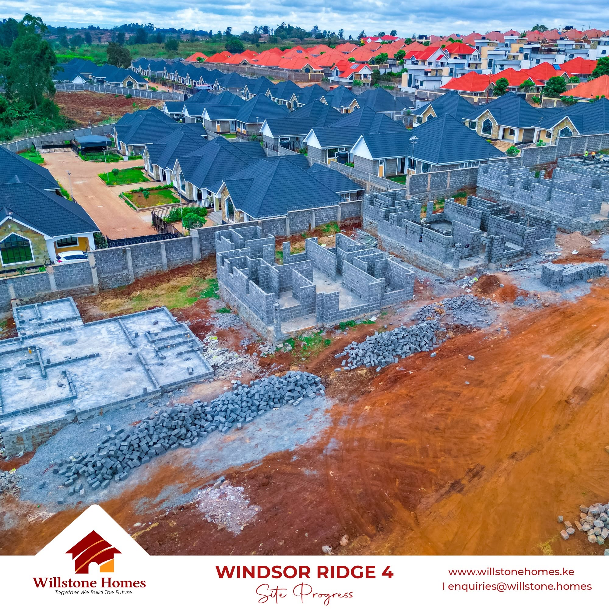
Imagine travelling 60 years into the future and stepping into the Nairobi of 2086.
The metropolis has expanded far beyond its 20th-century boundaries. Places once considered distant rural peripheries have matured into high-density commercial and residential hubs. Areas along Nairobi’s expanding metropolitan transit corridors—such as Joska, Kamulu, Malaa, Kitengela, and Ruiru—have transformed from open plains into bustling, high-density urban centres accommodating millions.
Now imagine walking through these 2086 neighbourhoods. In some, you find orderly street grids, tree-lined pedestrian walkways, integrated drainage systems, public parks, and seamless access to light rail and utility connections. In others, you navigate severe traffic congestion, mismatched structural designs, chronic urban flooding, inadequate sewer networks, and a complete absence of public open space.
The stark contrast between these two futures is not a matter of chance. It depends directly on the choices property owners, real estate developers, urban planners, and county authorities in the Nairobi Metropolitan Area (NMA) make today.
As Kenyans continue investing heavily in plots and residential units across peri-urban corridors, we must confront a fundamental question: Are we building resilient neighbourhoods that will serve future generations, or are we constructing structural headaches that our children and grandchildren will spend billions trying to fix?
The Danger of Uncoordinated “Plot-by-Plot” Urbanization

Across Nairobi and neighboring counties—including Kiambu, Machakos, and Kajiado—residential development continues at a rapid pace. Much of this growth follows an individualistic pattern: land buyers acquire individual $\frac{1}{8}$-acre or $\frac{1}{4}$-acre plots and construct homes according to personal budgets, tastes, and immediate family needs.
                  TYPICAL UNCOORDINATED DEVELOPMENT PATTERN
[ Standalone Bungalow ]  --->  [ 5-Story Rental Blocks ]  --->  [ Commercial Workshop ]
                        (Shared 6-Meter Unpaved Access Road)
                                         |
                                         v
               • Infrastructure Bottlenecks    • Stormwater Runoff
               • Parking Overflows             • No Reserved Public Space
While each decision makes sense to the individual investor, the cumulative outcome of uncoordinated development is systemic urban failure. When high-density apartment blocks rise next to single-family homes along narrow, six-meter access roads, the local infrastructure breaks down:
- Utility Strain: Power grids and water pipelines designed for low-density housing experience chronic overloads.
- Lack of Wayleaves: Without reserved public corridors (wayleaves), installing large-scale underground sewerage, fiber optic networks, or street lighting later becomes prohibitively expensive.
- Loss of Architectural & Functional Harmony: Commercial activities spill directly into quiet residential pockets, creating noise pollution and safety hazards.
A functional neighbourhood is not merely a collection of houses; it is a unified ecosystem where road networks, civil drainage, public health infrastructure, and green spaces must operate in harmony.
What Historical Estates Teach Us About Long-Term Urban Life
Nairobi’s urban history offers valuable lessons on why initial planning—and ongoing enforcement—matter.
The Buruburu Model
Developed in phases starting in the 1970s by the City Council of Nairobi alongside the Commonwealth Development Corporation (CDC), Buruburu was designed as a master-planned estate. It featured clear residential “cul-de-sacs,” integrated shopping centers, designated primary and secondary schools, playgrounds, and a hierarchical road network separating pedestrian lanes from vehicular traffic.
+-------------------------------------------------------------------------+
|                        BURUBURU DEVELOPMENT LESSONS                      |
+------------------------------------+------------------------------------+
| 1970s Planned Strengths             | Modern Challenges & Degradation     |
+------------------------------------+------------------------------------+
| • Structured cul-de-sac layouts    | • Unregistered extensions & extensions|
| • Integrated school & retail zones | • Conversion of green zones to shops|
| • Dedicated pedestrian walkways    | • Overburdened sewer infrastructure|
+------------------------------------+------------------------------------+
The Cautionary Tale
Over the decades, unregulated extensions, commercial conversions, and inadequate enforcement of zoning bylaws changed parts of Buruburu’s original character.
Key Takeaway for Emerging Corridors: If a master-planned estate like Buruburu can face structural degradation over a 50-year period due to lax zoning enforcement, emerging satellite settlements that begin without any initial master plan face a much higher risk of rapid decline.
Joska and the Satellite Frontier: A Pivotal Planning Moment

Settlements along the Kangundo Road corridor, such as Joska, Malaa, and Kamulu, represent the frontline of Nairobi’s expansion. As housing demand pushes home-seekers further from the Central Business District (CBD), these areas attract thousands of first-time land buyers.
       [ Nairobi CBD ] <======== Kangundo Road Corridor ========> [ Joska / Malaa ]
                                             |
                   +-------------------------+-------------------------+
                   |                                                   |
        [ Immediate Buyer Goal ]                            [ Long-Term Urban Reality ]
        • Secure land title deed                           • Access roads sub-standard
        • Build family home                                 • Drainage channels lacking
        • Move in quickly                                  • Public utility plots missing
When land subdivisions occur without strict adherence to the Physical and Land Use Planning Act (2019), critical community assets are omitted. A homeowner may construct a modern bungalow, only to find that:
- The unpaved access road becomes impassable during the rainy season.
- Rainwater runoff from neighboring paved compounds floods their courtyard due to lack of standard side-drainage.
- No land was set aside within a 5-kilometer radius for public health clinics, police posts, or municipal parks.
Five Critical Urban Risks Kenya Faces by 2086

If current land subdivision practices continue unchecked, satellite settlements across the Nairobi Metropolitan Area face five major structural risks over the next 60 years:
+--------------------------------------------------------------------------------+
|                   5 MAJOR RISKS FOR UNPLANNED URBAN SPRAWL                      |
+-------------------+------------------------------------------------------------+
| 1. Gridlock       | Narrow 6m roads prevent bus routes & emergency services    |
| 2. Flooding       | Paved surfaces increase runoff without standard drainage   |
| 3. Lost Greenery | Zero public parks, sports grounds, or recreational spaces  |
| 4. Value Loss     | Declining neighborhood quality depresses resale values     |
| 5. Debt Burden    | Massive future municipal costs to compulsorily acquire land|
+-------------------+------------------------------------------------------------+
1. Severe Road Network Bottlenecks
Access roads that serve twenty single-family plots become completely blocked when those same plots are redeveloped into multi-story residential apartments. Widening these roads decades later requires expensive compulsory land acquisition and structural demolitions. Emergency vehicles—such as fire engines and ambulances—struggling to navigate narrow corridors put lives at risk.
2. Infrastructure Deficits and Flooding
As concrete surfaces replace open soil, rainwater runoff increases exponentially. Without reserved drainage corridors and planned stormwater channels, localized flash flooding becomes routine. Retrofitting subterranean sewer networks into fully built-up, unplanned areas costs up to five times more than laying infrastructure beforehand.
3. Complete Loss of Public and Recreational Spaces
Without firm regulatory enforcement requiring developers to surrender a percentage of sub-divided land for public utility, open spaces disappear. By 2086, entire urban districts could exist without a single public park, community playground, or green corridor, negatively impacting public health and community well-being.
4. Depreciation of Long-Term Real Estate Value
A building’s value relies heavily on its surrounding environment. Properties located in estates with working infrastructure, wide access roads, clear security perimeters, and active management retain capital appreciation better than higher-specification homes trapped in degraded, chaotic environments.
5. High Financial Burden for Future Generations
When today’s planners fail to set aside public land, future county governments must spend taxpayer money buying back private property at high market rates to build basic infrastructure—such as schools, water treatment plants, and road expansions.
The Strategic Advantage of Master-Planned Communities

To prevent these urban challenges, Kenya’s real estate sector is increasingly turning to master-planned gated communities and controlled developments.
In a structured master-planned community, urban layout precedes construction:
- Determined Road Widths: Main arterial roads and feeder streets are clearly mapped and paved before plot handover.
- Integrated Utilities: Water reticulation, underground electrical conduits, drainage canals, and waste management systems are built into the design.
- Controlled Architectural Guidelines: Guidelines preserve aesthetic cohesion, building set-backs, height restrictions, and floor-area ratios, protecting the visual appeal and financial value of the entire neighborhood.
- Dedicated Amenities: Green parks, commercial zones, and recreational facilities are permanently set aside for residents.
       UNCONTROLLED SPRAWL                             MASTER-PLANNED COMMUNITY
+---------------------------------+              +---------------------------------+
| [Home]  [5-Story Apt]  [Shop]   |              | [Park/Green Zone]  [Paved Road] |
|   |          |           |      |              |         |               |       |
| (Narrow, Unpaved 6m Roadway)    |              |  [Controlled Residential Units] |
| (No Drainage / No Green Space)  |              | (Integrated Drainage & Utilities)|
+---------------------------------+              +---------------------------------+
Shared Responsibility: Building for the Next Century

Creating sustainable urban centers across Nairobi, Machakos, Kiambu, and Kajiado requires active collaboration across four key groups:
                         SUSTAINABLE URBANIZATION
                                    |
     +-----------------+------------+------------+-----------------+
     |                 |                         |                 |
[ County Govts ]  [ Real Estate Devs ]     [ Land Buyers ]   [ Urban Planners ]
• Enforce Zoning  • Master-Plan Infrastr.  • Due Diligence   • Design Scalable
• Protect Spaces  • Deliver Built Utility  • Demand Controls   Transit Corridors
- County Governments: Must enforce the Physical and Land Use Planning Act, streamline development approvals, protect public utility lands from encroachment, and invest in regional bulk infrastructure.
- Real Estate Developers: Should move beyond selling un-serviced plots toward delivering fully master-planned estates with complete civil infrastructure.
- Property Buyers: Must perform thorough due diligence—checking county spatial plans, verifying access road widths, ensuring proper drainage provisions, and prioritizing controlled developments over unregulated subdivisions.
Shaping the Nairobi of 2086 Today
Six Decades from now, today’s children will be leaders, today’s young homeowners will be grandparents, and many of the structures built today will define Kenya’s urban landscape.
The question is not whether the Nairobi Metropolitan Area will expand—it will. The real question is what quality of life that expansion will deliver.
By prioritizing controlled master planning, infrastructure-led land development, and responsible estate management today, developers like Willstone Homes and forward-thinking property buyers can ensure that the urban centers of 2086 are vibrant, sustainable, and prosperous communities for generations to come.
Partner with Willstone Homes
Building Thoughtfully Planned Communities for Tomorrow’s Kenya.
- Phone: +254 711 082011
- Email: [email protected]
- Head Office: Park Suites, 44 Parklands Road, Ground Floor, Suite 1, Nairobi, Kenya.